EBC Trek
Book a private tour for a more personalized experience. Contact us on WhatsApp, Viber, or call +977 9851350078. Or simply click “Check Availability,” choose your date, select the Private option, and complete your booking.
-
Guaranteed Available PackagesFridaySeptember 25, 2026ThursdayOctober 8, 2026$1,18030Available
-
Guaranteed Available PackagesSaturdayOctober 10, 2026FridayOctober 23, 2026$1,18030Available
Book the best Everest Base Camp trek for 2025. Enjoy guaranteed departures, expert guides, and stunning views from Kala Patthar. All-inclusive & secure. Book now!

While standing atop the 8,848m summit of Mt. Everest is a dream for many, the reality of the climb is reserved for a few. However, for those with a spirit of adventure and a steady heart, Everest Base Camp is within your reach. We provide a comprehensive and expertly coordinated Everest Base Camp Trek program, meticulously designed to exceed your expectations

We believe the view from Kala Patthar is the true reward—offering a more breathtaking panorama of the Everest massif than any other point on earth. This isn’t just a tour; it’s a rugged, life-changing immersion into the Himalayas. You’ll stay in traditional teahouses where the luxury isn’t in the thread count, but in the morning sun hitting the peaks outside your window. From steaming plates of authentic Dal Bhat to the camaraderie of the Khumbu Valley, every moment is an experience of a lifetime. Your safety is our priority: we provide expert-led acclimatization and hydration strategies to ensure you conquer the trail comfortably.
Short on time? Witness the grandeur via our Everest Base Camp Helicopter Tour.
To help you prepare for your arrival, please check the official immigration portal for all visa-related details: Nepal Immigration
Overview
The Everest Base Camp Trek is one of the world’s most iconic trekking adventures, offering a perfect blend of natural beauty, cultural richness, and personal achievement. Nestled in the heart of Nepal’s Khumbu region, this legendary journey takes you to the foot of Mount Everest (8,848.86 m), the highest peak on Earth, following the historic trails used by early mountaineers and local Sherpa communities.
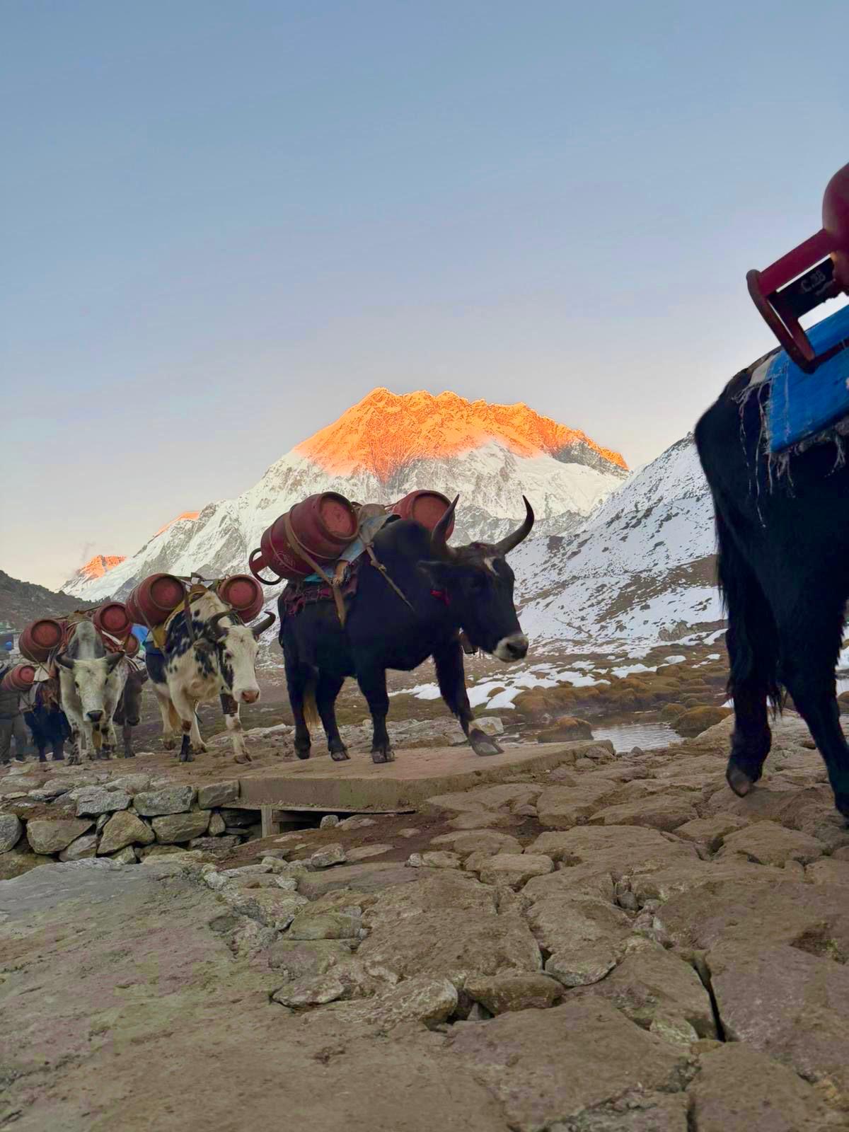
The trek begins with a scenic flight from Kathmandu to Lukla, one of the most thrilling mountain airstrips in the world. From there, the trail winds through charming Sherpa villages such as Phakding, Namche Bazaar, Tengboche, Dingboche, and Lobuche, each offering unique insights into Himalayan life. Along the way, trekkers are treated to breathtaking views of towering peaks including Ama Dablam, Lhotse, Nuptse, Cho Oyu, and Everest itself.
Beyond its dramatic landscapes, the Everest Base Camp Trek is deeply enriched by culture and spirituality. Ancient monasteries, fluttering prayer flags, spinning prayer wheels, and the warm hospitality of the Sherpa people create a meaningful cultural experience. A visit to Tengboche Monastery, the most important monastery in the Khumbu region, is a spiritual highlight of the trek.
The journey is carefully designed to allow proper acclimatization, with rest days in Namche Bazaar and Dingboche, ensuring a safe and enjoyable experience. Reaching Everest Base Camp (5,364 m) is a powerful moment, offering close-up views of the Khumbu Icefall and a profound sense of accomplishment. Most itineraries also include a hike to Kala Patthar (5,545 m), the best viewpoint for sunrise over Mount Everest.
Suitable for adventurous travelers with a good level of fitness, the Everest Base Camp Trek is more than just a hike—it is a once-in-a-lifetime journey into the heart of the Himalayas, combining adventure, culture, and awe-inspiring scenery in an unforgettable way.
Highlight of Everest Base Camp Trek
- Namche Bazaar, The Sherpa Capital: This horseshoe-shaped village is the vibrant hub of the Khumbu region. It’s where you’ll spend your first acclimatization days. Highlights: Bustling markets, mountain-view bakeries, and the Hillary Museum. It is also the first spot where you can catch a distant glimpse of Mount Everest.
- Tengboche Monastery: Perched at 3,867 meters, this is the spiritual heart of the Khumbu. The monastery is famous for its intricate wall paintings and the backdrop of the stunning Ama Dablam. If you time your visit right, you can observe monks performing daily prayers and chants, offering a moment of profound serenity.
- Kala Patthar: The "Everest" Viewpoint: While Base Camp is the goal, Kala Patthar ($5,545m$) provides the actual reward. Because Everest is partially hidden from the base camp by other ridges, trekkers hike to this "Black Rock" for the most iconic, 360-degree panoramic view of Everest, Lhotse, and Nuptse, especially spectacular at sunrise.
- Sagarmatha National Park: The entire trek takes place within this UNESCO World Heritage Site. You’ll walk through Lush rhododendron forests (blooming in spring) and pine-covered valleys. Keep an eye out for the Himalayan Tahr (wild goat), the colorful Danphe (Nepal’s national bird), and the elusive Red Panda.
- Khumbu Glacier and Icefall: As you approach Base Camp, you’ll walk alongside the massive Khumbu Glacier, the highest glacier in the world. From Base Camp itself, you can look up at the terrifyingly beautiful Khumbu Icefall, a shifting river of ice towers that mountaineers must navigate to reach the summit.
- Authentic Teahouse Culture: Staying in local "teahouses" (mountain lodges) allows you to experience the legendary Sherpa hospitality. You’ll spend evenings huddled around a central wood-burning stove, sharing stories with fellow trekkers from around the globe while enjoying a hot plate of Dal Bhat.
- The Legendary Flight to Lukla: The adventure begins even before you start walking. The flight from Kathmandu (or Ramechhap) to Tenzing-Hillary Airport in Lukla is world-famous. Landing on a short, uphill runway perched on a mountain shelf is an adrenaline-pumping experience that offers your first dramatic views of the Himalayas.
Detailed Itinerary
Our 14-day Everest Base Camp (EBC) itinerary is widely considered the "Gold Standard" of trekking. Its primary feature is a scientifically backed ascent profile that balances the thrill of the journey with the physical necessity of oxygen adaptation.
Here is a high-level overview of why this specific plan is the most recommended:
1, Strategic Acclimatization (The "Safety First" Feature)
Unlike shorter or "express" treks that skip rest days, this itinerary includes two critical Acclimatization Days:
Namche Bazaar (3,440m): This is the "gateway" to the high Himalayas. Staying here for two nights allows your body to adjust before crossing the 4,000m "thin air" threshold.
Dingboche (4,410m): This second stop is vital because oxygen levels drop significantly here. It prepares you for the final push to Base Camp ($5,364$m) and Kala Patthar ($5,545$m).
2, Cultural & Spiritual Immersion
This route isn't just a walk; it's a deep dive into Sherpa Culture:
Tengboche Monastery: You visit the largest Buddhist monastery in the Khumbu region, often witnessing monks during their evening prayers against the backdrop of Mt. Ama Dablam.
Namche’s Amphitheater: You experience the bustling hub of Sherpa life, complete with bakeries (the world's highest), Irish pubs, and museums dedicated to the history of Everest climbers.
Mani Walls and Stupas: The trail is lined with sacred stones and prayer wheels, requiring trekkers to pass them on the left, honoring local Buddhist traditions.
3, Iconic Visual Highlights
The 12-day route is designed to hit the "Big Three" visual milestones:
The Hillary Bridge: A dizzying, prayer-flag-draped suspension bridge high above the Dudh Koshi River.
Everest Base Camp (EBC): Standing on the Khumbu Glacier at the foot of the world’s highest peak, surrounded by the shifting ice towers of the Khumbu Icefall.
Kala Patthar (The "Black Rock"): While EBC is the goal, Kala Patthar is the view. It offers the most famous 360-degree panorama of Everest, Lhotse, and Nuptse that you cannot actually see from Base Camp itself.
4, Diverse Ecological Transition
The trek features a dramatic shift in landscape that keeps the scenery fresh:
Days 1–4: Lush rhododendron and pine forests, roaring glacial rivers, and green valleys.
Days 5–8: The "Alpine Zone"—a lunar-like landscape of rock and ice where trees disappear and giant peaks loom in every direction.
Your Everest Base Camp (EBC) adventure begins with your arrival in Kathmandu, the vibrant capital of Nepal. After landing at Tribhuvan International Airport, you’ll be warmly greeted by a representative and transferred to your hotel in the heart of the city.
Once you’ve checked in, the rest of the day is kept relatively relaxed to allow you to recover from your journey and adjust to the new surroundings. Depending on your arrival time, you may have the opportunity to take a short walk around the neighborhood—exploring lively streets, local shops, cafés, and glimpses of Kathmandu’s rich culture.
In the late afternoon or evening, you’ll meet your trek leader and fellow trekkers for an official welcome and briefing session. During this meeting, the guide will:
Introduce the overall EBC trekking route and daily plan
Go over safety guidelines, altitude awareness, and acclimatization strategy
Check trekking permits and important documents
Review your gear and suggest any last-minute rentals or purchases
Answer questions and address any concerns
This is also a great chance to get to know your trekking group and build excitement for the journey ahead.
This day is divided into two distinct parts: a thrilling mountain flight and a gentle introductory trek.
Part 1: The Flight (Kathmandu to Lukla)
Duration: 30–40 minutes
Altitude Change: 1,400m (Kathmandu) to 2,860m (Lukla)
The Experience: Departure: You will likely head to the airport around 5:30 AM to 6:30 AM. Flights are scheduled early to take advantage of clear morning weather.
The Landing: You’ll land at Tenzing-Hillary Airport (Lukla), famous for its short, uphill runway carved into the side of a mountain.
Note on Ramechhap/Manthali: During peak seasons (March–May, Oct–Nov), flights often operate from Ramechhap/Manthali instead of Kathmandu to reduce air traffic. This requires a 4–5 hour drive from Kathmandu starting around 1:00 AM.
Part 2: The Trek (Lukla to Phakding)
After landing in Lukla, you’ll usually have breakfast and meet your trekking crew (porters and guides) before hitting the trail.
Trek Overview
| Detail | Information |
| Distance | Approximately 8 km (5 miles) |
| Trekking Time | 3 to 4 hours |
| Difficulty | Easy (Introduction Day) |
| Highest Point | 2,860m (Lukla) |
| Lowest Point | 2,610m (Phakding) |
Trail Highlights
The Descent: Paradoxically, the first day of the “climb” actually involves a net descent of about 200m. This helps your body adjust slightly before the big climb to Namche Bazaar the next day.
Pasang Lhamu Gate: You’ll exit Lukla through this memorial arch, named after the first Nepali woman to summit Everest.
Sherpa Villages: You will pass through several small settlements including Chheplung and Ghat.
Dudh Koshi River: The trail follows the “Milk River,” so named for its icy, milky-white waters. You will cross your first few suspension bridges draped in colorful prayer flags.
Mani Stones: You’ll encounter large boulders carved with Buddhist mantras. Tradition dictates you should always walk to the left of these stones.
This day is a transition from the lush, lower river valleys into the high-altitude Sherpa heartland. It is characterized by multiple suspension bridge crossings and a steep final ascent.
Trek Overview
| Detail | Information |
| Distance | Approx. 11–12 km (7.4 miles) |
| Trekking Time | 6 to 7 hours |
| Difficulty | Moderate to Challenging (Steep uphill finish) |
| Starting Altitude | 2,610m (Phakding) |
| Ending Altitude | 3,440m (Namche Bazaar) |
| Altitude Gain | +830m |
Trail Highlights
The Riverside Trail (Phakding to Monjo):
The first half of the day is a pleasant walk that crisscrosses the Dudh Koshi River.
Bengkar Village: You’ll pass through this beautiful settlement, known for its views of the waterfall and the towering peak of Thamserku (6,623m).
Monjo (2,835m): This is the gateway to the Sagarmatha National Park. Your guide will handle the park permits and entry formalities here.
Jorsalle and the “Water-Driven” Prayer Wheels
After Monjo, you enter the national park and descend to Jorsalle, the last village before the big climb. Most trekkers stop here for an early lunch to fuel up for the strenuous afternoon ahead.
The Hillary Suspension Bridge
Shortly after Jorsalle, you will reach a spectacular sight: two suspension bridges stacked one above the other. You will cross the higher one—the Hillary Suspension Bridge. It hangs high above the river gorge and is often draped in thousands of wind-whipped prayer flags.
The “Namche Hill” Ascent
Once across the bridge, the real work begins. The trail turns into a steep, zig-zagging forest path.
The First View: About halfway up this hill, there is a small “Everest View Point.” On a clear day, this is your very first glimpse of Mount Everest peeking over the Lhotse-Nuptse ridge.
The Final Stretch: The climb is relentless for about 2 hours. Steady breathing and a slow pace (“Bistari, Bistari” in Nepali) are key here.
Arrival in Namche Bazaar
As you top the hill, the trail levels out and reveals the “Sherpa Capital.” Namche is built in a natural horseshoe-shaped amphitheater.
The Vibe: It is surprisingly modern, featuring cafes, bakeries, trekking gear shops, and even Irish pubs.
Acclimatization: Because of the significant altitude gain (jumping above 3,000m), you will typically spend two nights here to let your body adjust.
Rather than staying sedentary, the goal is to keep the body active by hiking to a higher altitude and then returning to Namche to sleep. The hike to the Everest View Hotel is the gold standard for this.
The Experience: Step-by-Step
The Steep Climb out of Namche
The morning begins with a steep stone-staircase climb directly behind the village. It is a slow, steady zig-zag that offers a bird’s-eye view of the horseshoe-shaped Namche Bazaar shrinking below you.
The Syangboche Airstrip
You will reach an old, unpaved airstrip at Syangboche. While it’s rarely used for planes now, it serves as a flat plateau where you can catch your breath and see the peaks of Thamserku and Kusum Kanguru in full glory.
The Arrival at Everest View Hotel
Listed in the Guinness Book of World Records as the highest placed hotel in the world, this spot offers a 360-degree panorama.
The Ritual: Most trekkers sit on the outdoor stone terrace, order a pot of ginger lemon honey tea, and simply stare at the horizon.
The First Glimpse of Mt. Everest
While you may have seen a small sliver of Everest through the trees on the climb from Phakding, the view from the Everest View Hotel is the “Official First Glimpse” that takes your breath away.
The Sight: You are looking directly across the valley at the world’s highest peak. Everest (8,848m) appears as a black, rocky pyramid.
The “Plume”: You can often see the famous “snow plume” (actually high-altitude clouds) blowing off the summit due to the Jet Stream.
The Neighbors: Everest is flanked by the massive white wall of Lhotse (8,516m) and the sharp ridge of Nuptse (7,861m).
Ama Dablam: To the right, you will see what many consider the most beautiful mountain in the world, Ama Dablam (6,812m), looking like a mother’s arms extended in a hug.
Afternoon: Exploring Namche
After descending back to town for lunch, the afternoon is free to explore.
Sherpa Culture Museum: Located near the military camp, it offers incredible history on Sherpa traditions and mountaineering.
Hillary School: A short walk to the village of Khumjung to see the school established by Sir Edmund Hillary.
The Bakeries: Treat yourself to a slice of apple pie or a brownie at the “World’s Highest Bakery”—you’ve earned the calories!
Hike Overview
| Detail | Information |
| Duration | 3 to 4 hours (round trip) |
| Difficulty | Moderate (Steep but short) |
| Starting Altitude | 3,440m (Namche) |
| Highest Point | 3,880m (Everest View Hotel) |
| Vertical Gain | +440m |
The trek from Namche Bazaar to Tengboche is widely considered one of the most beautiful walking days in the world. It combines wide-angle Himalayan panoramas with a deep immersion into the spiritual heart of the Khumbu region. This day is a mix of “Everest Flat” (winding, undulating trails) and a sharp, final climb through rhododendron forests to reach the famous monastery.
Trek Overview
| Detail | Information |
| Distance | Approx. 10 km (6.2 miles) |
| Trekking Time | 5 to 6 hours |
| Difficulty | Moderate |
| Starting Altitude | 3,440m (Namche) |
| Ending Altitude | 3,867m (Tengboche) |
| Altitude Gain | +427m (Net) |
Trail Highlights
The “Everest Highway“
The trail begins with a spectacular, relatively flat walk clinging to the side of the mountain high above the Dudh Koshi River.
The View: This stretch offers uninterrupted views of Everest, Lhotse, and Ama Dablam. Because you are walking on a balcony-like trail, the mountains feel like they are right beside you.
Wildlife: Keep an eye out for the Danphe (Himalayan Monal), the colorful national bird of Nepal, or Himalayan Tahr (mountain goats) grazing on the cliffs.
The Descent to Phunki Thenga
After a couple of hours of easy walking, the trail drops steeply through pine forests down to the river. You will reach the small settlement of Phunki Thenga (3,250m).
The Lunch Stop: This is the standard place to eat and hydrate before the big afternoon climb.
Water Prayer Wheels: Note the prayer wheels powered by the rushing mountain streams
The Spiritual Ascent
After lunch, you cross a bridge and begin the final, steady zig-zag climb toward Tengboche.
The Forest: You’ll walk through lush forests of rhododendron and birch. If you are trekking in Spring (March/April), the trees will be blooming in vibrant reds and pinks.
The Kani (Archway): As you reach the top of the ridge, you pass through a traditional stone gateway that opens up into the wide, grassy plateau of Tengboche.
Arrival in Tengboche
Tengboche is not just a village; it is a spiritual sanctuary. It sits on a high ridge with a 360-degree view that includes the massive Everest massif and the towering Ama Dablam.
Tengboche Monastery: This is the largest and most significant Tibetan Buddhist monastery in the Everest region. It is beautifully ornate with colorful wall paintings and a 20-foot statue of Buddha.
The Monk’s Chanting: If you arrive by late afternoon (around 3:00 PM or 4:00 PM), you may be able to enter the monastery (respectfully and without shoes) to witness the
The trek from Tengboche to Dingboche is the day the landscape transforms. You leave the lush greenery and tall trees behind, crossing the “tree line” into a high-altitude, alpine wilderness that feels like another planet. This day is all about gradual ascent and massive mountain perspectives. You move closer to the base of Ama Dablam and enter the wide, wind-swept Imja Valley.
Trek Overview
| Detail | Information |
| Distance | Approx. 9 km (5.6 miles) |
| Trekking Time | 5 to 6 hours |
| Difficulty | Moderate (Feeling the altitude) |
| Starting Altitude | 3,867m (Tengboche) |
| Ending Altitude | 4,410m (Dingboche) |
| Altitude Gain | +543m |
Trail Highlights
The day begins with a gentle descent from the Tengboche ridge through a forest of birch, conifers, and rhododendrons. The moss-covered trees often look like something out of a fairy tale. You’ll cross a small suspension bridge over the Imja Khola.
Walking Under the Shadow of Ama Dablam
After crossing the river, the trail starts to climb gradually. For several hours, you will walk directly alongside the base of Ama Dablam. From this angle, the mountain looks completely different—it is so close you can see the ice seracs hanging from its ridges.
Pangboche: The Upper Village
You will pass through Pangboche (3,930m), the highest year-round settlement in the region.
The Gompa: Pangboche Monastery is the oldest in the Khumbu and once famously claimed to house a “Yeti Scalp.”
Lunch Stop: Most trekkers stop here or in nearby Somare for lunch. Notice that the trees are now becoming stunted shrubs—a sign you are entering the alpine zone.
The Alpine Desert
After lunch, the trail opens up into a vast, treeless valley. The air becomes noticeably thinner. You will reach a trail junction: the left path goes to Pheriche, while the right path leads you across the river and up a final ridge into the hidden valley of Dingboche.
Arrival in Dingboche
Dingboche is a beautiful village protected by stone walls to keep the high-altitude winds from damaging the crops (mostly barley and buckwheat).
The “Summer Valley”: Unlike other villages, Dingboche feels wide and open. It is the only place in the region where you can see the peaks of Island Peak (6,189m) and the massive south face of Lhotse so clearly.
The “Dingboche Wall”: You’ll notice miles of hand-stacked stone walls protecting the fields—a testament to Sherpa hardiness.
Evening Prep: It gets significantly colder here once the sun goes down. Most lodges gather everyone around the central yak-dung-burning stove in the dining hall.
By the time you reach Dingboche, you are above 4,400m (14,435ft). This second acclimatization day is arguably more critical than the one in Namche, as you are now entering the “thin air” zone where the risk of Altitude Mountain Sickness (AMS) increases significantly.
The goal today is to push your body to nearly 5,000m to trigger the production of more red blood cells, then descend back to the village for a heavy lunch and a long nap.
Hike Overview: Nangkartshang Peak
| Detail | Information |
| Duration | 3 to 5 hours (round trip) |
| Difficulty | Challenging (Steep and thin air) |
| Starting Altitude | 4,410m (Dingboche) |
| Highest Point | ~4,800m to 5,083m (depending on turnaround) |
| Vertical Gain | +400m to +670m |
The Experience: Step-by-Step
The “Golden Hour” Start
Most trekkers begin the hike after a late breakfast (around 8:30 AM or 9:00 AM). The trail starts immediately behind the village, ascending the steep ridge of Nangkartshang Peak. There is no “flat” here; it is a direct upward slog on a rocky, dusty path.
The View of Three of the World’s Six Highest Peaks
As you gain height, the panorama behind you opens up. This is one of the few places on earth where you can see three 8,000-meter giants from one spot:
Lhotse (8,516m): Directly ahead, looking like a massive wall of ice.
Makalu (8,485m): Appearing to the East, a distinct fifth-highest pyramid in the distance.
Cho Oyu (8,188m): Visible far to the West if the weather is perfectly clear.
The Imja Valley Panorama
Looking down to your right, you will see the entire Imja Valley stretching out toward the base of Island Peak. You’ll also get a bird’s-eye view of the glacial lakes and the dramatic, sharp ridges of Ama Dablam, which looks close enough to touch from this altitude.
Reaching the Prayer Flags
Most trekkers aim for a viewpoint marked by a cluster of Buddhist prayer flags at around 4,800m–5,000m. At this height, every step feels heavy. You’ll spend 30–60 minutes at the top to let your body “register” the altitude before descending.
Afternoon: Rest and Hydration
The descent to Dingboche is quick—usually taking less than an hour. The afternoon is strictly for recovery.
Hydration: Guides will insist you drink 3–4 liters of water today.
The Bakeries: Dingboche has a couple of surprisingly good bakeries (like the “4410 Bakery”) that show mountain movies in the afternoon. It’s a great way to stay warm and social without exerting energy.
Health Check: This is the evening your guide will likely pay close attention to your oxygen saturation levels (using a pulse oximeter) and your appetite, ensuring you are ready for the push to Lobuche the next day.
The trek from Dingboche to Lobuche is a day of profound emotional and physical shifts. You leave the wide Imja Valley and turn north toward the Khumbu Glacier, passing through a somber and beautiful memorial site before reaching the high-altitude settlement of Lobuche. This day is defined by the “Thukla Pass,” a steep climb that leads to a plateau filled with memorials for fallen climbers, followed by a walk alongside the terminal moraine of the world’s highest glacier.
Trail Highlights
The Pheriche Plateau
The day begins with a gentle climb to the ridge above Dingboche before dropping slightly to join the main trail coming up from Pheriche. You’ll walk across a wide, desolate plain. The peaks of Taboche and Cholatse tower over you to the left, looking like giant white teeth against the blue sky.
Thukla (Dughla) and the Steep Climb
After about 2 hours of relatively flat walking, you reach Thukla (4,620m), a small cluster of tea houses. This is the last stop before the steep ascent of the Thukla Pass.
The Slog: The climb up the “lip” of the glacier is short but intense. At this altitude (nearly 4,700m), you will find yourself stopping every few minutes to catch your breath.
The Everest Memorial (Thukla Pass)
As you reach the top of the pass, the terrain flattens into a plateau. This is one of the most moving places in the Himalayas.
The Chortens: The area is filled with stone monuments (chortens) dedicated to climbers and Sherpas who lost their lives on Everest.
Famous Names: You will find memorials for Scott Fischer (from the 1996 disaster) and Babu Chiri Sherpa. The silence here, punctuated only by the snapping of prayer flags in the wind, is incredibly powerful.
The Khumbu Glacier Moraine
From the memorial, the trail levels out but becomes very rocky. You are now walking alongside the lateral moraine of the Khumbu Glacier. You cannot see the ice yet—it is hidden under a massive layer of rock and debris—but you can feel the cold air radiating from it. To your right, the peaks of Pumori and Nuptse dominate the skyline.
Arrival in Lobuche
Lobuche is a small, cold, and busy settlement tucked between the moraine and the mountain wall.
The Atmosphere: It feels like a true high-altitude “base camp” town. Lodges here are basic and can get very crowded as everyone funnels into this narrow valley.
The Sunset: If the weather is clear, step outside to see the sunset hit the Nuptse wall. The massive rock face turns a deep, fiery orange.
Early Night: Oxygen levels are roughly 50% of what they are at sea level. You will likely feel a bit lethargic; the best medicine is a hot soup, early sleep, and plenty of water to prepare for the “Big Day” at Base Camp.
This is the “Big Day”—the culmination of your journey. It is physically grueling due to the extreme altitude, but the adrenaline of reaching your goal usually carries you through. You will trek to the final settlement, drop your bags, and push on to the base of the world’s highest peak.
This day involves navigating the lateral moraine of the Khumbu Glacier. The terrain is unstable, rocky, and breathtakingly beautiful.
Trek Overview
| Detail | Information |
| Total Distance | Approx. 13 km (8 miles) round trip |
| Trekking Time | 7 to 9 hours |
| Difficulty | Strenuous (Extreme altitude) |
| Highest Point | 5,364m (Everest Base Camp) |
| Sleeping Point | 5,164m (Gorak Shep) |
| Oxygen Level | Approx. 50% of sea level |
Trail Highlights
The Rocky Path to Gorak Shep
The morning starts early (usually around 6:00 AM). The trail from Lobuche to Gorak Shep is a series of “up and down” undulations over glacial debris and loose rocks.
The Khumbu Glacier: You are walking parallel to this massive river of ice. You may hear the occasional “crack” or “boom” of the glacier moving or an avalanche echoing off the surrounding peaks.
Arrival at Gorak Shep (5,164m): After 2–3 hours, you reach this tiny outpost. It was the original base camp for the 1953 expedition. You will have a quick lunch here and leave your heavy packs in your room.
The Push to Everest Base Camp
From Gorak Shep, the trail to EBC follows the ridge of the glacier. It is not a steep climb, but the “Everest Flat” terrain is exhausting because of the thin air.
The Khumbu Icefall: As you approach, the terrifyingly beautiful Khumbu Icefall—a jagged “waterfall” of massive ice towers (seracs)—comes into clear view.
The Terrain: The trail eventually drops down onto the glacier itself. Watch your step, as the path changes every year due to the shifting ice.
Reaching the Goal: Everest Base Camp (5,364m)
You’ll know you’ve arrived when you see the iconic rock covered in signatures and the prayer flags stretched across the boulders.
The Sight: During the spring (April–May), the area is a “yellow city” of hundreds of expedition tents. In other seasons, it is a silent, rocky landscape of ice and stone.
The View: Note that you cannot see the actual summit of Everest from Base Camp (it’s hidden behind the West Ridge and Nuptse), but you are standing at the foot of the beast, surrounded by the world’s most formidable peaks.
The Return: Back to Gorak Shep
After spending 30–60 minutes taking photos and soaking in the achievement, you must turn back.
The Fatigue: The 2–3 hour walk back to Gorak Shep can be the hardest part of the day. The adrenaline wears off, and the cold begins to bite as the sun starts to drop.
Mental Focus: Stay focused on your footing; the rocky moraine requires concentration even when you are exhausted.
Evening in Gorak Shep
Gorak Shep is the highest you will sleep on this trek. It is notoriously difficult to get a deep sleep at this altitude, and it is very cold.
The Celebration: Most groups share a celebratory ginger tea. You’ve made it to EBC!
Rest: Try to rest as much as possible, because most trekkers wake up at 4:00 AM the next morning for the optional (but highly recommended) climb of Kala Patthar for the best view of the Everest summit.
This is often the most physically exhausting but visually rewarding day of the entire trek. While Everest Base Camp is the “goal,” Kala Patthar is the “view.” You will stand at the highest point of your journey before making a massive descent to the thicker, richer air of Pheriche.
This day is a game of two halves: a grueling pre-dawn climb to the highest vantage point, followed by a long, knee-jarring descent back down the valley.
Trek Overview
| Detail | Information |
| Duration | 7 to 9 hours (total) |
| Difficulty | Very Strenuous |
| Highest Point | 5,545m (Kala Patthar Summit) |
| Ending Altitude | 4,240m (Pheriche) |
| Altitude Loss | -1,305m (from the summit) |
Trail Highlights
The Pre-Dawn Ascent of Kala Patthar
Most trekkers start between 4:00 AM and 5:00 AM.
The Cold: Temperatures can drop to -15°C to -20°C. Your headlamp will light a narrow path as you tackle the steep, dark, and wind-swept slope.
The Effort: This is a 2-hour “test of lungs.” Because you are above 5,000m, you may find yourself taking five steps and then pausing for breath.
The “Black Rock”: Kala Patthar means “Black Rock” in Nepali. The summit is a jagged pile of boulders covered in prayer flags.
The Ultimate Sunrise (The First Glimpse of the Summit)
From the summit of Kala Patthar, you get the most famous view in the Himalayas.
Everest Unveiled: Unlike at Base Camp, the entire South Face of Mount Everest is visible here. As the sun rises behind the mountain, the sky turns purple, then orange, hitting the summit pyramid first.
The Panorama: You are surrounded by a theater of giants: Pumori, Nuptse, Lhotse, and Ama Dablam. Below you, the Khumbu Glacier looks like a giant, frozen river of stone.
The Return to Gorak Shep
The descent back to Gorak Shep takes about an hour. You’ll have a quick, celebratory breakfast, pack your bags, and begin the long trek down. You will notice that with every meter you descend, your breathing becomes slightly easier.
The Descent via Thukla
You retrace your steps past Lobuche and back to the Thukla Pass memorial. Looking at the memorials in the daylight after having reached your goal often feels even more poignant. From Thukla, instead of heading to Dingboche, you take the lower trail toward Pheriche.
Arrival in Pheriche
Pheriche is located in a deep, wind-swept valley just below Dingboche.
The Himalayan Rescue Association (HRA): Pheriche is home to a famous high-altitude medical clinic. In the trekking season, volunteer doctors give daily lectures on altitude sickness.
Thicker Air: At 4,240m, you are more than 1,000 meters lower than you were a few hours ago. You will likely have your best night’s sleep in a week and a significantly improved appetite.
The Atmosphere: The village is often very windy in the afternoons, but the lodges are cozy, and the sense of relief among trekkers heading down is palpable.
The trek from Pheriche back to Namche Bazaar is a day of “returning to life.” While the distance is significant, the vast majority of the trail is downhill. As you descend, the oxygen levels rise, the temperature warms, and the barren alpine moonscape transforms back into lush green forests.
This is a long but rewarding day. You will cover in one day what took you nearly three days to climb on the way up, fueled by the “oxygen high” of descending to lower altitudes.
Trek Overview
| Detail | Information |
| Distance | Approx. 14–15 km (9 miles) |
| Trekking Time | 6 to 8 hours |
| Difficulty | Moderate (Long distance, but mostly downhill) |
| Starting Altitude | 4,240m (Pheriche) |
| Ending Altitude | 3,440m (Namche Bazaar) |
| Altitude Loss | -800m (Net loss) |
Trail Highlights
Retracing the Imja Khola
The trail starts with a gentle walk out of the Pheriche valley before climbing a small ridge to join the main path. You’ll pass through Somare and Pangboche. Looking back, you’ll see the summit of Everest and Ama Dablam receding into the distance—a final “goodbye” to the high peaks.
The Re-entry into the Trees
After crossing the suspension bridge near Deboche, you enter the “Magic Forest” again. The smell of pine needles and rhododendrons is often the first thing trekkers notice—a sharp contrast to the dry, dusty air of the high altitudes. You’ll make the short, final climb back up to the Tengboche Monastery plateau.
The Big Descent to Phunki Thenga
From Tengboche, the trail drops steeply through a series of dusty switchbacks down to the river at Phunki Thenga.
The Sensation: Your knees will feel the impact here, but your lungs will feel incredible. Many trekkers find they can walk much faster than they did just a few days ago.
The “Everest Highway” in Reverse
After a final climb out of the river gorge (which feels much easier now that you are acclimated), you traverse the wide, winding balcony trail back toward Namche. The trail hugs the cliffs, offering one last look at the massive Himalayan range.
Arrival in Namche Bazaar
Walking back into Namche feels like returning to a major city. The sights, sounds, and smells are overwhelming after the silence of the high mountains.
The Celebration: This is the night most trekkers celebrate. You can finally visit the Irish Pub (the highest in the world) for a beer or head to a bakery for a fresh croissant.
The First Shower: Many lodges in Namche have reliable gas-powered hot showers. After a week of “baby wipe baths,” this is often the highlight of the trip.
Connectivity: You’ll likely get your first strong Wi-Fi signal here, allowing you to send photos of your EBC success to friends and family.
Evening in Namche
You’ll notice your energy levels are much higher. Spend the evening browsing the souvenir shops for yak wool blankets or “I Survived EBC” t-shirts. The air is thick, the beds are comfortable, and the sense of accomplishment is immense.
The final day of trekking is a long, emotional journey. You are retracing the very first steps of your adventure, but as a completely different person—physically leaner, lungs acclimated to the thin air, and carrying the memory of standing at the base of the world’s highest peak.
This is your longest trekking day in terms of distance. While it is mostly a descent, there is a “sting in the tail”—a final uphill climb into Lukla that tests your resolve one last time.
Trek Overview
| Detail | Information |
| Distance | Approx. 18–19 km (11.5 miles) |
| Trekking Time | 7 to 8 hours |
| Difficulty | Moderate to Strenuous (due to distance) |
| Starting Altitude | 3,440m (Namche) |
| Ending Altitude | 2,860m (Lukla) |
| Altitude Loss/Gain | Significant descent followed by a final climb |
Trail Highlights
The “Great Descent” (Namche Hill)
The day begins with the steep descent down the Namche Hill. On the way up, this took hours of gasping for air; on the way down, you’ll likely fly through it in 45 minutes.
The Hillary Bridge: You’ll cross the high suspension bridge one last time, looking down at the rushing Dudh Koshi River you’ve followed for the last week.
Exiting the National Park
You’ll pass back through Jorsalle and then Monjo, where you will officially check out of the Sagarmatha National Park. The air here feels heavy and rich with oxygen, making you feel “superhuman” in your walking pace.
The Rolling Hills of Phakding
The trail between Monjo and Phakding is a series of gentle ups and downs through lush forests and Sherpa villages. You’ll stop in Phakding (where you spent your first night) for a final trail lunch. It’s a moment of reflection—remembering how nervous and excited you felt in this exact spot just 10 days ago.
The Final Climb to Lukla
Many trekkers forget that the last 45 minutes of the trek is a steady uphill climb. After a long day of walking, this final stretch into Lukla can be mentally taxing. You’ll pass back through the Pasang Lhamu Gate, signaling the official end of your trek.
Arrival in Lukla
Entering Lukla feels like crossing a finish line. The town is buzzing with two types of people: nervous trekkers just starting out, and exhausted, smiling trekkers like you who have finished.
The “Last Supper”: It is tradition to host a final dinner for your trekking crew (guides and porters). It’s the time to hand out tips and say your goodbyes, as many porters live in the lower Valleys and won’t fly back to Kathmandu with you.
Celebration: The Starbucks (unofficial) or the local pubs in Lukla are usually filled with trekkers sharing stories and a final drink.
The Flight Check: Your guide will reconfirm your flight for the next morning. Flights out of Lukla are highly weather-dependent, so everyone keeps a close eye on the clouds.
Evening in Lukla
You’ll sleep in a proper bed tonight, likely dreaming of the flight out tomorrow. You’ve completed the legendary circuit!
The circle is finally complete. The return to Kathmandu marks the transition from the rugged, silent world of the Himalayas back to the vibrant, sensory-rich chaos of Nepal’s capital. It is a day of deep contrast—going from a mountain lodge to a hot shower and a soft hotel bed.
This day is all about the “Lukla Lottery” (the weather) and the sweet relief of returning to city comforts.
Part 1: The Flight (Lukla to Kathmandu)
Duration: 30–40 minutes.
The Routine: Much like your arrival, this starts early. You’ll head to the Tenzing-Hillary Airport around 6:00 AM or 7:00 AM.
The Takeoff: Taking off from Lukla is even more thrilling than landing. The plane accelerates down the short, downhill runway and “drops” into the valley before catching lift.
The View: For a final farewell to the peaks, try to sit on the right-hand side of the plane this time to see the Himalayan range one last time.
Weather Contingency: Lukla is notorious for fog and wind. If flights are grounded, you may spend an extra day in Lukla, or in some cases, travelers opt for a helicopter flight back to Kathmandu if the fixed-wing planes cannot fly.
Part 2: Arrival & The “Cultural Shock”
Stepping out of the Kathmandu domestic terminal is a shock to the system. The quiet of the mountains is replaced by honking horns, colorful rickshaws, and the smell of street food. A private transfer will take you back to your hotel (usually in Thamel).
The Free Day in Kathmandu
Once you’ve checked in and had that long-awaited long hot shower, the day is yours to enjoy. Here are the most popular ways to spend your “Free Day”:
The “Clean Clothes & Comfort Food” Strategy
Laundry: Drop your trekking gear at a local laundry service in Thamel; they usually have it clean and dry within 6 hours.
The First Real Meal: Many trekkers head straight to places like OR2K or Roadhouse Cafe for a wood-fired pizza or a fresh salad—things you likely avoided on the trail.
Sightseeing (The Recovery Walk)
If you still have some energy, visit one of the UNESCO World Heritage sites:
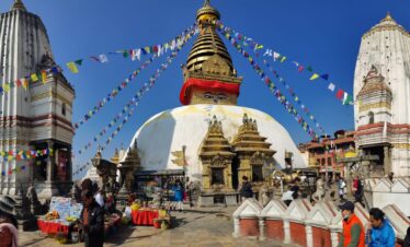
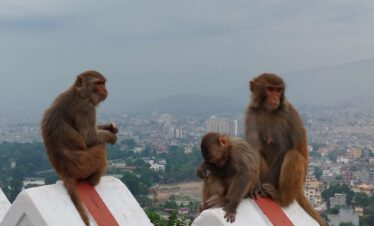
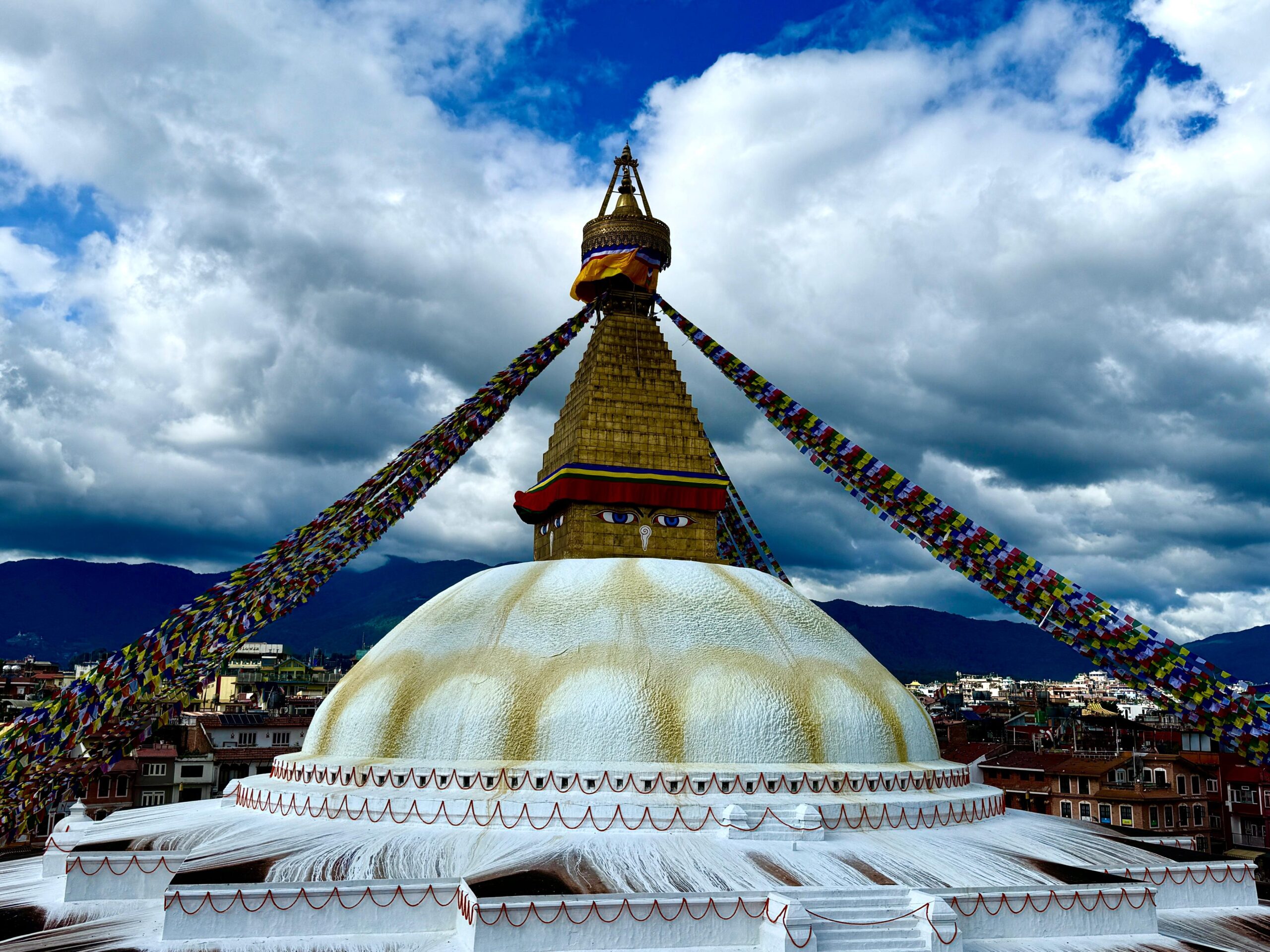
Swayambhunath (Monkey Temple): A short taxi ride away. Climb the final stairs for a panoramic view of the entire Kathmandu Valley.
Kathmandu Durbar Square: Walk through the ancient courtyard of the Malla kings and see the home of the Kumari (the Living Goddess).
Last-Minute Shopping
Thamel is a maze of shops. It is the perfect time to buy:
Cashmere/Pashmina: High-quality shawls and scarves.
Singing Bowls: Hand-hammered brass bowls used for meditation.
Thangka Paintings: Intricate Buddhist mandala art.
The Farewell Dinner
Most trekking agencies organize a farewell dinner at a traditional Nepali restaurant featuring local dance and music. It’s the perfect time to share a final meal with your guide, exchange contact info with new friends, and toast to your successful journey to the base of the world’s highest peak.
The final day of your journey is a bittersweet transition. It is the moment you say goodbye to the “Roof of the World” and the team that helped you reach it, beginning your journey back home with a lifetime of memories and a new perspective. Your last day in Nepal is designed to be stress-free, ensuring you reach the airport with plenty of time for your international flight.
The Final Morning: Last Moments in Kathmandu
Depending on your flight schedule, you may have a few final hours in the city.
Final Breakfast: Enjoy a slow morning with a cup of Himalayan coffee.
Packing: Most trekkers find their bags are a little heavier on the way home, packed with souvenirs, prayer flags, and perhaps a bit of Himalayan dust.
Check-out: Standard hotel check-out is usually around 11:00 AM or 12:00 PM, but hotels are happy to store your luggage if your flight is in the evening.
The Farewell & Staff Send-Off
We believe that the people you meet are as important as the mountains you see. Your departure is handled with the same care as your arrival.
The Pick-up: Our staff will arrive at your hotel in a private vehicle approximately 3 hours before your flight.
The Khada Ceremony: In keeping with Nepali and Sherpa tradition, your guide or a company representative may present you with a Khada (a traditional silk ceremonial scarf). This symbolizes good luck, a pure heart, and a wish for a safe journey home.
The Transfer: As you drive through the streets of Kathmandu one last time, it’s a great chance to ask your guide any final questions about the culture or history you witnessed during your trek.
A Heart Full of Memories
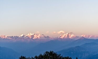
As you board your flight and look out the window, you might catch one last glimpse of the white peaks of the Himalayas. You aren’t just leaving with photos; you are leaving with the grit it took to climb Namche Hill, the silence of the Thukla Pass, and the triumph of standing at Everest Base Camp.
“Pheri Bhetaula” — This is a common Nepali farewell. It doesn’t just mean “Goodbye,” it means “We shall meet again.”
Inclusions/Exclusions
Cost Includes
- Arrival & Departure: Private airport transfers to and from your hotel in Kathmandu.
- 2 or 3 nights in a standard hotel in Kathmandu (usually Thamel-based) with breakfast.
- 10 to 11 nights in mountain tea houses (lodges) during the trek.
- Transportation: Round-trip domestic flights (Kathmandu/Ramechhap to Lukla) including airport taxes.
- Meals: Full board on the trek (Standard Breakfast, Lunch, and Dinner). Note: Group Joining option doesn't include BLD plan during Trek days.
- Staff: A government-licensed, English-speaking lead guide.
- Strong local porters (usually 1 porter for every 2 trekkers) to carry your main duffel bag.
- All staff wages, insurance, equipment, and flight costs.
- Permits: * Sagarmatha National Park Entry Permit. Khumbu Pasang Lhamu Rural Municipality Permit (Local Trekking Permit).
- A comprehensive First Aid kit carried by the guide.
- Pulse Oximeter to monitor oxygen saturation levels daily.
Cost Excludes
- International Airfare: Flights to and from your home country.
- Nepal Entry Visa: Currently $30 for 15 days or $50 for 30 days (payable in cash at Kathmandu airport).
- Meals in Kathmandu: Lunches and dinners while in the city (so you can explore local restaurants).
- Travel Insurance: This is mandatory and must cover emergency helicopter evacuation and medical expenses at altitudes up to 6,000m.
- Personal Gear: Trekking boots, sleeping bags, down jackets, and hiking poles (though high-quality gear can be rented in Kathmandu).
- Tea House Extras: Hot showers and battery charging (phones/cameras).
- Wi-Fi or internet access cards.
- Breakfast Lunch and Dinner for Group Joining option.
- Beverages: Bottled water, soda, specialty coffees, and alcoholic drinks.
- Tips: Gratuity for the guide and porters at the end of the trip.
- Emergency Costs: Any expenses resulting from flight delays, trail closures, personal illness or any other unavoidable circumstances (extra nights in a hotel, etc.).
EBC Trek
Book a private tour for a more personalized experience. Contact us on WhatsApp, Viber, or call +977 9851350078. Or simply click “Check Availability,” choose your date, select the Private option, and complete your booking.
-
Guaranteed Available PackagesFridaySeptember 25, 2026ThursdayOctober 8, 2026$1,18030Available
-
Guaranteed Available PackagesSaturdayOctober 10, 2026FridayOctober 23, 2026$1,18030Available
Frequently Asked Questions for EBC Trek
You don’t need to be an elite athlete, but you should have a good level of cardiovascular fitness. The trek is a “walk,” not a climb, but you will be hiking 5–8 hours a day on rocky, uneven terrain. The real challenge is the altitude, not the technicality of the path.
AMS occurs when your body doesn’t get enough oxygen. We prevent it by:
The “Slow and Steady” Rule: Never rushing.
Acclimatization Days: Staying two nights in Namche and Dingboche.
Hydration: Drinking 3–4 liters of water daily.
Medication: Many trekkers carry Diamox (Acetazolamide) after consulting their doctor.
Yes, but it usually costs extra. Most tea houses offer gas-powered hot showers for $3–$7. Charging your phone or power bank costs $2–$5 per charge.
Tip: Bring a high-capacity power bank and spare camera batteries to save money.
Never drink tap water. You should use water purification tablets, a LifeStraw, or UV purifiers. While you can buy bottled water, it becomes very expensive ($4 per bottle) and creates plastic waste in the mountains.
If you cannot continue due to injury or severe AMS, your guide will coordinate a helicopter evacuation. This is why Travel Insurance is mandatory and must specifically cover “trekking up to 6,000 meters” and “emergency helicopter rescue.”
The menu is surprisingly diverse!
Dal Bhat: Lentil soup, rice, and curry (the best fuel; it’s bottomless!).
International: Pasta, pizza, pancakes, and eggs.
Advice: Avoid meat above Namche Bazaar. All meat is carried up by porters without refrigeration, so the risk of food poisoning is high.
There are two main windows:
Spring (March–May): Warmer weather and blooming rhododendrons. This is when the Everest climbers are at Base Camp.
Autumn (October–November): The clearest skies and best mountain views, though it is colder than spring.
Tipping is a standard practice in Nepal. As a general rule, many trekkers tip about 10–15% of the total trek cost. This is usually split among the crew, with the guide receiving a bit more than the porters.
Most tea houses offer Wi-Fi (often via “Everest Link” cards), but it can be slow and unreliable due to weather. You can also buy a local SIM card (Ncell or NTC) in Kathmandu, though signal is spotty above 4,000m.
Lukla flights are weather-dependent. If planes are grounded, you may have to wait for the next clear window. We recommend having 2–3 buffer days at the end of your trip in Kathmandu before your international flight home to account for these potential delays.